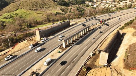
The scenic Cabrillo Highway, also known as California State Route 1, stretches along the stunning California coast, offering breathtaking views of the Pacific Ocean and surrounding landscape. However, this picturesque route is also prone to closures due to various factors such as landslides, roadwork, and weather conditions. For travelers and locals alike, it’s essential to stay informed about these closures to plan their journeys accordingly. Here are 10 notable Cabrillo Highway closures that you should be aware of to ensure a smooth and safe trip:
Mud Creek Slide: One of the most significant closures in recent years, the Mud Creek Slide has been a recurring issue. Heavy rainfall causes the hillside to become unstable, leading to the closure of the highway. When planning your trip, check for updates on this section, as it can be closed for extended periods.
Big Sur Landslide: The Big Sur area is known for its rugged beauty, but it’s also susceptible to landslides. A major landslide in this area can block the highway, and while efforts are made to clear the road as quickly as possible, closures can last from days to weeks. Keep an eye on local news and traffic updates for the latest information.
Bixby Bridge Repairs: The iconic Bixby Bridge is not only a popular tourist stop but also a critical part of the Cabrillo Highway. Occasionally, the bridge undergoes repairs or maintenance, which can lead to lane closures or full highway closures. These are usually scheduled during less busy times to minimize disruption.
Rocky Creek Bridge Work: Another critical piece of infrastructure along the Cabrillo Highway, the Rocky Creek Bridge, may experience closures due to maintenance or repair work. This is a vital section of the road, and any work here is done with the aim of ensuring the bridge’s stability and safety.
Paul’s Slide: This area is prone to slides, especially during the rainy season. Paul’s Slide can cause debris to flow onto the highway, necessitating its closure until the road can be safely cleared. Regular checks on road conditions are essential if you’re planning to drive through this section.
Gorda Closure: The remote community of Gorda, known for its scenic views and limited services, can sometimes find itself cut off due to highway closures. This can happen due to various reasons, including slides, roadwork, or accidents. Travelers should always have a backup plan, including supplies and accommodations, in case they find themselves stranded.
Tree Removal: After heavy winds or storms, trees may fall onto the highway, requiring removal. While these closures are typically short-lived, they can still cause significant delays, especially if the trees are large or the removal process is complex.
Wildfire Precautions: California is well-known for its wildfire risks, and the area around the Cabrillo Highway is no exception. During high fire danger times, the highway may be closed as a precautionary measure to prevent the spread of fires and to ensure public safety.
Search and Rescue Operations: Occasionally, the highway may be closed to facilitate search and rescue operations. These can be due to missing persons, vehicle accidents, or other emergencies where access is needed for rescue teams.
Scheduled Maintenance: Like any highway, the Cabrillo Highway requires regular maintenance to keep it safe and functional. This can include repaving, drainage work, and other tasks that might necessitate lane closures or, in some cases, full closures of the highway. These works are usually planned during off-peak hours to minimize inconvenience to travelers.
Planning Ahead
Given the potential for these closures, it’s crucial for anyone planning to travel along the Cabrillo Highway to check for updates before embarking on their journey. Here are a few tips to help you plan ahead:
- Check Official Websites: The California Department of Transportation (Caltrans) provides up-to-date information on road conditions and closures. Regularly checking their website can give you the latest information on the status of the highway.
- Use Traffic and Navigation Apps: Apps like Waze or Google Maps can provide real-time traffic information, including road closures and detours. They can be invaluable in helping you navigate around closed sections of the highway.
- Subscribe to Alerts: Many local news outlets and traffic services offer alert systems for road closures. Subscribing to these can keep you informed of any sudden changes in road conditions.
- Plan for Flexibility: Sometimes, despite the best planning, closures can occur with little warning. Being flexible with your travel plans and having alternative routes or accommodations in mind can help mitigate the impact of unexpected closures.
Conclusion
The Cabrillo Highway is a gem of California’s landscape, offering a drive like no other. While closures can be inconvenient, understanding the reasons behind them and planning ahead can make all the difference in ensuring your trip is enjoyable and stress-free. By staying informed and being prepared, you can navigate the challenges posed by highway closures and enjoy the breathtaking beauty of the California coast.
How often does the Cabrillo Highway close?
+The frequency of closures on the Cabrillo Highway can vary greatly depending on the time of year, weather conditions, and maintenance schedules. It’s not uncommon for parts of the highway to close during the rainy season due to landslides or during the summer for wildfires and maintenance.
What is the best way to get real-time updates on Cabrillo Highway closures?
+The best way to get real-time updates is by checking the official Caltrans website, using traffic and navigation apps like Waze or Google Maps, or subscribing to local news and traffic alert services.
Are there any alternative routes if the Cabrillo Highway is closed?
+Yes, depending on the location of the closure, there may be alternative routes available. However, these can add significant time to your journey. It’s a good idea to consult a map or a navigation app for the most current and efficient detour.