Navigating the charming city of Santa Barbara, with its rich Spanish architecture and stunning coastal landscape, can be a breeze if you know how to read a map. Whether you’re a first-time visitor or a seasoned local, understanding the layout of the city and its various neighborhoods is essential to making the most of your time in this beautiful California town.
To start, it’s helpful to have a physical or digital map of Santa Barbara that highlights its main streets, landmarks, and points of interest. The city’s downtown area is relatively compact and easy to navigate on foot, with State Street serving as the main thoroughfare. This bustling street is lined with shops, restaurants, and cultural attractions, making it an excellent place to begin your exploration.
One of the first things you’ll notice when looking at a map of Santa Barbara is the grid-like pattern of its streets. The city’s founders designed the street layout with a series of blocks and avenues, making it straightforward to find your way around. The main streets, such as Anacapa, Chapala, and De la Vina, run north-south, while the cross streets, like Carrillo, Micheltorena, and Sola, run east-west.
When reading a map of Santa Barbara, pay attention to the various neighborhoods, each with its unique character and charm. The Downtown area, as mentioned, is the hub of activity, with its vibrant shops, eateries, and entertainment venues. The Waterfront area, which includes the famous Stearns Wharf and the Santa Barbara Harbor, offers breathtaking views of the Pacific Ocean and the surrounding coastline. The Mesa, a charming neighborhood located just west of downtown, is known for its beautiful parks, scenic views, and historic adobes.
To find your way fast in Santa Barbara, it’s essential to familiarize yourself with the city’s main landmarks and their locations. The Santa Barbara Mission, a historic landmark and one of the city’s most iconic attractions, is situated at the intersection of Laguna and Los Olivos streets. The Santa Barbara County Courthouse, another prominent landmark, is located at 1100 Anacapa Street, in the heart of downtown.
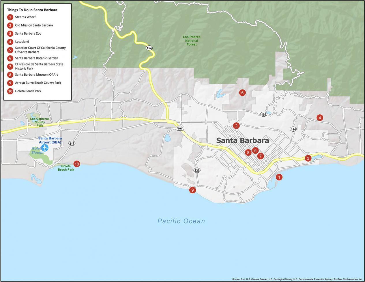
In addition to understanding the city’s layout and landmarks, it’s also helpful to know how to use the map to plan your itinerary. Look for symbols and markings that indicate points of interest, such as parks, museums, and restaurants. Many maps of Santa Barbara also include a key or legend that explains the various symbols and colors used to denote different types of attractions and services.
For those who prefer to navigate using digital maps, there are several excellent resources available. The City of Santa Barbara’s official website offers an interactive map that allows users to search for specific locations, get directions, and explore the city’s various neighborhoods and attractions. Google Maps is another excellent resource, providing detailed street maps, real-time traffic information, and turn-by-turn directions to help you find your way around the city.
In conclusion, reading a map of Santa Barbara is a straightforward process that requires a basic understanding of the city’s layout, landmarks, and neighborhoods. By familiarizing yourself with the city’s main streets, attractions, and services, you’ll be able to navigate this beautiful coastal town with ease and confidence. Whether you’re visiting for a day or a week, taking the time to learn how to read a map of Santa Barbara will help you make the most of your time in this charming California city.
Insider Tip: Consider purchasing a detailed map of Santa Barbara that includes information on the city's public transportation system, including bus routes and schedules. This can be a convenient and affordable way to get around the city, especially for those who prefer not to drive or rent a car.
Understanding Santa Barbara's Neighborhoods

Santa Barbara is comprised of several unique neighborhoods, each with its own character and charm. Understanding these neighborhoods and their locations can help you navigate the city more easily and find the attractions and services you’re looking for. Here’s a brief overview of some of Santa Barbara’s most popular neighborhoods:
- Downtown: The heart of Santa Barbara, downtown is home to the city’s main shopping and dining district, as well as many of its most popular attractions, including the Santa Barbara Mission and the Santa Barbara County Courthouse.
- The Waterfront: This scenic neighborhood is located along the coast and offers stunning views of the Pacific Ocean. It’s home to Stearns Wharf, the Santa Barbara Harbor, and many excellent seafood restaurants.
- The Mesa: A charming neighborhood located just west of downtown, the Mesa is known for its beautiful parks, scenic views, and historic adobes.
- Santa Barbara’s Eastside: This up-and-coming neighborhood is home to a diverse range of shops, restaurants, and cultural attractions, including the Santa Barbara Bowl, a popular outdoor music venue.
Step-by-Step Guide to Navigating Santa Barbara
- Start by familiarizing yourself with the city's main streets and landmarks, including State Street, the Santa Barbara Mission, and the Santa Barbara County Courthouse.
- Use a map or digital navigation tool to get an overview of the city's layout and plan your itinerary.
- Consider purchasing a detailed map of Santa Barbara that includes information on the city's public transportation system, including bus routes and schedules.
- Take some time to explore the city's various neighborhoods, including downtown, the Waterfront, the Mesa, and the Eastside.
- Don't be afraid to ask for directions or seek advice from locals, who are always happy to share their knowledge of the city with visitors.
Common Mistakes to Avoid When Reading a Map of Santa Barbara

While reading a map of Santa Barbara is a relatively straightforward process, there are several common mistakes that can lead to confusion and frustration. Here are a few things to watch out for:
- Not taking the time to familiarize yourself with the city’s main streets and landmarks.
- Not using a map or digital navigation tool to plan your itinerary.
- Not considering the city’s public transportation system, including bus routes and schedules.
- Not exploring the city’s various neighborhoods, which can lead to a lack of understanding of the city’s layout and attractions.
- Not asking for directions or seeking advice from locals, who can provide valuable insights and recommendations.
Pros and Cons of Using a Digital Map vs. a Physical Map
Pros of Using a Digital Map:
- Convenience: Digital maps are easily accessible on your smartphone or tablet, making it easy to navigate the city on the go.
- Real-time information: Digital maps often provide real-time traffic information, helping you avoid congested areas and plan your route more efficiently.
- Customization: Digital maps allow you to customize your route and plan your itinerary based on your specific needs and preferences.
Cons of Using a Digital Map:
- Dependence on technology: Digital maps require a reliable internet connection and a charged battery, which can be a challenge in areas with limited coverage.
- Limited detail: While digital maps provide a wealth of information, they can lack the detail and nuance of a physical map, making it more difficult to understand the city's layout and attractions.
- Distractions: Digital maps can be distracting, especially when used while driving or walking, which can increase the risk of accidents and injuries.
Pros of Using a Physical Map:
- Tactile experience: Physical maps provide a tactile experience, allowing you to touch and feel the map as you navigate the city.
- No dependence on technology: Physical maps do not require a reliable internet connection or a charged battery, making them a more reliable option in areas with limited coverage.
- Detail and nuance: Physical maps often provide more detail and nuance than digital maps, making it easier to understand the city's layout and attractions.
Cons of Using a Physical Map:
- Size and weight: Physical maps can be bulky and heavy, making them more difficult to carry and store.
- Updating: Physical maps can become outdated quickly, requiring frequent updates and replacements.
- Cost: Physical maps can be more expensive than digital maps, especially for large or detailed maps.
What is the best way to get around Santa Barbara without a car?
+Santa Barbara has an excellent public transportation system, including buses and a downtown shuttle. You can also walk or bike in the downtown area, or take a taxi or ride-share service.
What are some of the most popular attractions in Santa Barbara?
+Santa Barbara is home to many popular attractions, including the Santa Barbara Mission, the Santa Barbara County Courthouse, Stearns Wharf, and the Santa Barbara Harbor.
What are some of the best neighborhoods to stay in while visiting Santa Barbara?
+Santa Barbara has many excellent neighborhoods to stay in, depending on your preferences and budget. Some popular options include downtown, the Waterfront, and the Mesa.
What is the best time of year to visit Santa Barbara?
+Santa Barbara is a year-round destination, but the best time to visit depends on your preferences. The summer months (June to August) are warm and sunny, while the winter months (December to February) are cooler and more rainy. The spring (March to May) and fall (September to November) are mild and pleasant, making them ideal for outdoor activities.
What are some tips for navigating Santa Barbara’s streets and roads?
+Santa Barbara’s streets and roads can be narrow and winding, especially in the downtown area. Be sure to drive slowly and carefully, and watch for pedestrians and cyclists. It’s also a good idea to use a map or GPS device to help navigate the city’s streets.